We visit the west shore of Caples Lake in Alpine County. The Overland Emigrant Trail passes through here, with some of it covered by the lake. We visit the west shore to see where the trail rises from the lake and heads west towards Mellisia Cory Pass.
1922 Moreland Truck at Johnson's Pass
Recently I was contacted by Greg Hull, who had worked for Cal Trans for thirty-three years as a construction engineer. His Father-in-Law was Darel Kehlet, whose family bought 640 acres on the west shore of Lake Tahoe and built Meeks Bay Resort from 1915-1969. Greg had inherited many family photos showing the resort's early development and surrounding highways and by-ways. He has kindly permitted these photos to be shared.
We see the Meek's Bay Resort Truck at the top of Johnson’s Pass at Echo Summit, looking east towards Lake Tahoe. The photo dates from 1922 or shortly after. It shows a man, woman, and dog, outside the truck, which has stopped at the pass. Johnson’s Pass was always a popular spot for travelers to snap photos. Just outside the frame, to the right, would be the Echo Summit Canteen Service Station owned by TC Wholbruck, whom we discussed.
In the early days of automotive travel, trucks and cars would have to back up steep hills as these vehicles had not yet been equipped with fuel pumps. On its journey "down the hill" towards Placerville, this truck would include a drive backing up the nearby Slippery-Ford Grade on the Lincoln Highway. What an experience that must have been.
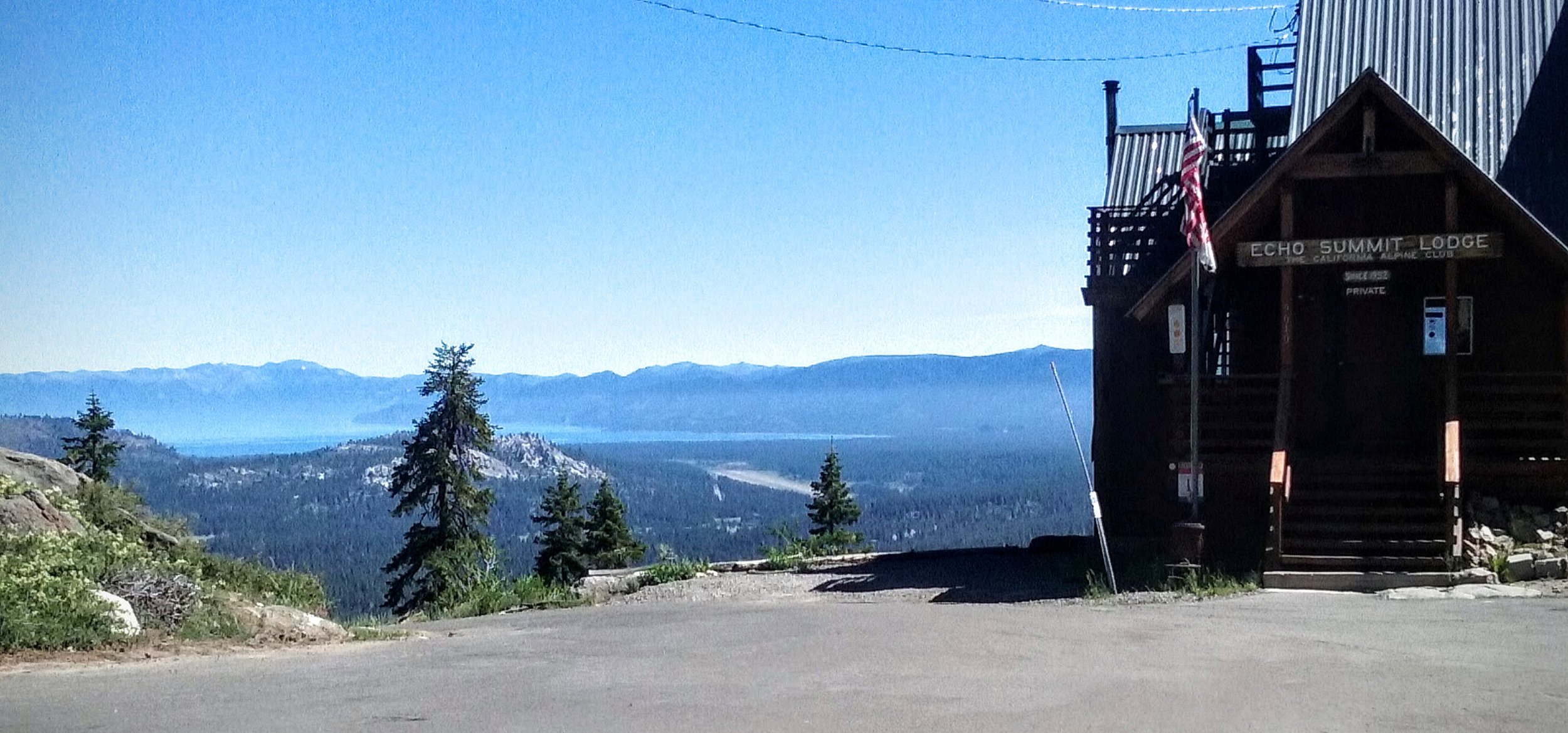
The same spot today!
Thanks to Greg Hull for sharing this and some other photos I hope to post here shortly. I have placed a comparison photo showing what the location looks like today
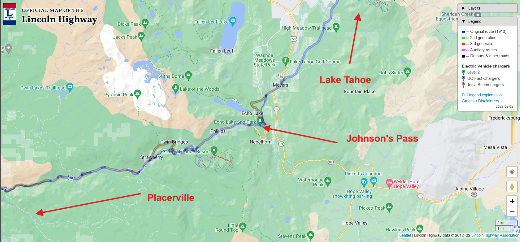
Location on map.
Lincoln Highway artifact found!
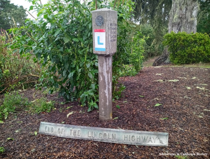
An exciting discovery of a long-lost artifact from the terminus of the Lincoln Highway has been found and is now in possession of the Lincoln Highway Association (LHA). The LHA replica concrete terminus post is shown above at the Palace of the Legion of Honor in Lincoln Park, San Francisco. That post was installed in 2002 by the LHA. The object below comes to us from 1917 and is the only known object remaining from the Terminus area. It read’s, END OF THE LINCOLN HIGHWAY.
The terminus of the Lincoln Highway had a metal sign attached to a post from 1915 to 1917 when the Native Daughters of the Golden West (NDGW) dedicated a large flag pole. The flag pole, made of a Douglas fir, had been washed ashore by the Golden Gate and dedicated to Betsy Ross, maker of the first flag of the United States. The pole had a bronze plaque that depicted an unfurled American flag. The circular base had two bronze strips affixed to the edge. One strip paid homage to Betsy Ross while the other proclaimed “END OF THE LINCOLN HIGHWAY.” The photo above, taken sometime after 1928, shows the plaque at the base.
Here we see the plaque with its aged bronzed patina sitting atop the fountain in front of the Palace of the Legion of Honor. The flag pole was removed, along with the concrete base in the c. 1970s. Why it was removed is unknown to us. All the parts of this monument were thought lost until now. This plaque is the oldest known remnant of any terminus monument.
To learn more about the history of the Terminus of the Lincoln Highway and enjoy more rare photos of the place and this object, please go to the California Chapter of the LHA Traveller Magazine, July 2014 here.
Following the Lincoln Highway at Zephyr Cove, Nevada
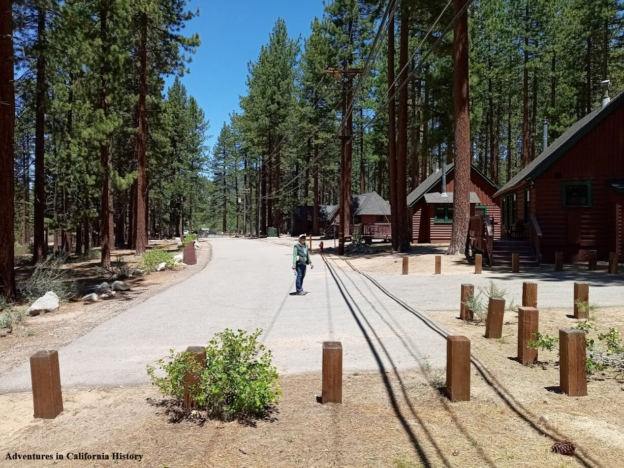
Monica is standing on the Lincoln Highway at the Zephyr Cove Lodge, Nevada. We had ventured over the state line following the Lincoln Highway up and over to Carson City. On the way, we stopped in Zephyr Cove to follow the highway's original course, which is behind the lodge on the current Highway 50. We are looking north in this photo.
Looking down the Lincoln Highway towards a fence that stops cars from entering the lodge area where Monica stood in the first photos. However, you can walk around the fence to access the lodge portion of the highway—some vintage cabins along the old road here.
The Old Lincoln Highway at Zephyr Cove is right along the water. It's just a hundred yards to the lake's edge. This strip of road has some great vintage cabins that once watched the transcontinental motorists pass by.
Turning around to face south, the old Lincoln Highway heads up the hill for about another 200 yards and eventually melds into the current Highway 50. Unfortunately, it’s a dead-end, and you’ll have to turn around and head back down the way you came.
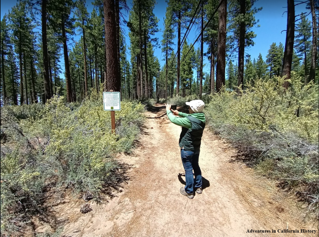
On the northern side of the Zephyr Cove Lodge parking lot is a dirt section of the old road. The Forest Service had placed a sign mentioning the importance of the old road. This section is some of the last original Lincoln Highway roadbeds around Lake Tahoe.
The Forest Service sign describing the Lincoln Highway around Lake Tahoe. Most of the road around Lake Tahoe was dirt back then. Imagine what an adventure it was for early motorists to travel around the lake on dirt wagon roads.
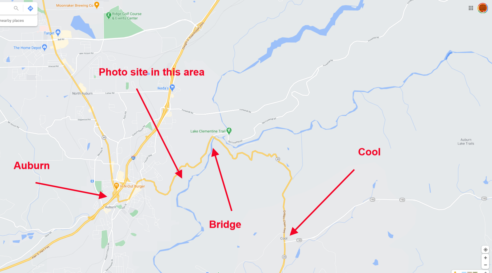
Map showing the general area around Zephyr Cove and the Lodge location.
Folsom, a Lincoln Highway Community
Earlier this year, I was contacted by the Historic District of the City of Folsom. They were interested in how to promote the Lincoln Highway through their area. After meeting with the Public Works Department, Folsom History Museum, and the Historic Folsom District, we agreed that the City would make and sign their section of the highway with our historic Lincoln Highway signs.
Historic Lincoln Highway sign being installed in the City of Tracy.
The Lincoln Highway was America’s first transcontinental highway for automobiles, conceived in 1913. Cities that found themselves on the new highway would reap the benefits of the increased traffic. To be a “Lincoln Highway community’ meant endless possibilities for commerce as the turn of the century “autoists” took to the freedom of the open road.
The photo above shows the Folsom Sacramento stage in front of the Folsom Stage Company. It looks like a John Wayne look-alike is the driver.
Folsom, having been on the old emigrant and wagon roads, found itself hosting this new concept, a transcontinental highway that went from Times Square in New York all the way to the Place of the Legion of Honor in San Francisco. Folsom soon built a new bridge, the Rainbow Bridge, across the American River. This bridge was to help with the transport of agricultural goods to the Transcontinental Railroad in neighboring Placer County.
Inmates from Folsom Prison helped in the construction of the highway in the Folsom area. Above is a “chain-gang” under supervision building the road.
The Folsom Museum holds a rare 1928 Lincoln Highway concrete post donated to the City by the California Chapter of the Lincoln Highway Association. Working with the museum, the historic post would hopefully be included in a permanent display inside the museum.
Rare original 1928 Lincoln Highway concrete marker at the Folsom Bridges event.
Along the original 1913 Lincoln Highway route through Folsom, our historic metal signs will guide the motorist along the old highway. Every day when people travel along these roads, they will be reminded of the historic nature of the route they are traveling on. The signs will pass through Folsom's historic district, attracting highway enthusiasts into that section of the community. It’s a great way to help boost historic district merchants who can celebrate the city's designation as a “Lincoln Highway Community.”
Bowman crossing and a newly found alignment of the Lincoln Highway.
The photo above, taken in the 1900s, shows the Bowman Crossing of the Southern Pacific Railroad. If you look closely, there is a person on a horse and another standing nearby. What caught my attention was the way the road makes a bend towards the photographer. If we head the other way, we will pass Machado’s Orchard on our way to Auburn once we cross the tracks. It was this photo that caused us to stop and check out this famous crossing again. We wanted to make sure our official Lincoln Highway map had the routes across the tracks marked correctly. We’ve checked out this area before but were unable to spot the old road. Recently someone has cleared out the area making it more open and visible.
The map at right will show the general area and some of the features discussed. We can see the two rail lines, the Lincoln Highway's blue line, and the crossing pictured in the historic photograph. East is to the right, west to the left. Notice how the crossing in the historic photo is actually west of our Lincoln Highway map shows the crossing. Click map for a larger view.
The same spot as the historic photo, but today. You can see our truck at the left.
In the photo below, we have moved east and can now see the road's impression at right. It appears that once you crossed the first rail line, you would take a hard right and head east. You can see Monica in the background on the road. Our truck is on the other side of the tracks at the crossing.
While the impression we were following could be the road, it would be nice to find some more evidence that this was indeed the transcontinental highway's route. We found the evidence because of the recent clearing of trees and shrubs in this area. We found a state “C” monument facing east and another just a few yards away. These markers were placed along state routes from 1914 to the 1930s. Finding these markers is a great affirmation you are on the right track.
Here we see Monica by the “C” monument. The taller metal sign has the letters R/W on it, which means “right of way.” Placer County has put these metal markers at the site of these older stone monuments. This makes finding the old monuments much easier in this county than others who don’t mark these. We found another marker just a few yards from this one, giving us the road's general route. See the map below for more detail.
Covey Rd., which we originally had our route marked on, is actually a road that crosses over Highway 80. We do not believe the Lincoln Highway route crossed where we had originally marked it. Below we have marked where we believe the route actually crossed the first tracks and then made its way towards crossing the second set of tracks. There a long-gone bridge crossed the second set of rail tracks.
To summarize, the Lincoln Highway crossed the first set of tracks at a different place than we had earlier thought. After crossing the first set of tracks, the road makes an immediate right, following alongside the rail line, just before where the present Bowman Road is, a sharp left, then another left to head towards crossing the long-gone bridge over the second set of tracks.
These changes to the route are sent to the Lincoln Highway Associations’ cartographer. If they agree with our findings, we will change the official map to show the newly found route.
Iowa Hills Baseball Team in the late 1800’s. Two boys sit by the tree. Photo: Placer County Museums.
Iowa Hills William "Seattle Bill" James, baseball legend
We have discussed the above photo in a post that can be found here. It shows the Iowa Hill baseball team posing with a couple of children sitting by a tree. All the small mining towns in the foothills fielded baseball teams, and Iowa Hill produced a player that would eventually pitch in the 1914 World Series. William "Seattle Bill" James was the waterboy for the Iowa Hill team and can be seen sitting by the tree holding a watering can! Bill was born in 1892 and looked to be about five or six in the photo, which would make the date of the photo around 1897 or 98.
William “Seattle Bill” James pitching for the Boston Braves.
William Lawrence James was the third of four children of William and Emma James. Bill's father was a gold miner in Iowa Hill, and when Bill was 11, the family moved to Oroville, where his father took a job on a mining dredge. While his parents wanted a mining degree for their son, Bill had other plans. In the three years that Bill attended Oroville high, he matured into a 6'3", 195-pound pitching phenom. When Seattle of the Northwestern League offered him a contract before the 1912 season, he left school for good. More about Bill here at the Society for American Baseball Research.
The above photo shows a baseball card with William pitching for the Boston Braves. Bill moved to the braves after playing for Seattle in 1912, where he was renowned for his fastball and spitball. William led the Seattle team to a pennant and helped guide the Braves to the championship. He was an early baseball superstar.
The photo below features James on a “cigar blanket”. I assume, because of the size of the “blanket”, that this actually sat inside a cigar box.
He attempted a comeback in 1918, but WWI called, so he served in the 63rd Infantry. There, his baseball arm came into use as he taught soldiers how to throw bombs. After the war, Bill played one major league game in 1919. From 1919 to 1925, he was a coach and player in the Pacific Coast League, from which he retired.
During retirement, Bill lived with his wife Harriet in Oroville. There he drove trucks and became an assessor for Butte County. He died on March 10, 1971, just shy of his 79th birthday., He is buried in Memorial Park Cemetery in Oroville.
Williams's story is fascinating as we can watch his development from a young waterboy in an isolated mountain town, Iowa Hill, to his fame as an early baseball player in the major league.
1910 horse/mule train near Auburn Ca. Photo: Placer County Museums
Horse team carrying sand for the construction of the Mountain Quarries Railroad
The Mountain Quarries Bridge and railroad were built in 1912 to bring limestone from the quarry to nearby Auburn. The construction that took place when animals worked alongside early 20th Century machines documented with this photo.
This photo looks like a mixed "pack train" of horses and mules. They are hauling sand for making concrete with teamster Charles Ray (on the lead horse). I counted 14 horses/mules, three men, and a dog, which can be seen in the close-up below.
A horse-mule pack train near Auburn and the Mountain Quarries Bridge, 1910. Photo from: Placer County Museums.
This spot looks familiar as we have hiked the Mountain Quarries Trail before. The concrete foundations seen in the photo are for a railroad trestle crossing, but not the Mountain Quarries Bridge. There are 17 places along the old railbed where they built trestles over canyons and sides of hills. We will try and take a photo of this spot next time we hike the trail.
Monica walking a section of the old Rattlesnake Bar Road.
Rattlesnake Bar Road and Bridge site
Folsom Lake has receded enough that artifacts the lake submerged over 70 years ago are visible once again. We have explored the site of the Rattlesnake Bar Bridge before. On this visit, we also walked the old road section that had made an appearance since the water has receded. We had wondered about the route of the road and how it made its way to the bridge. A wonderful section of the road is quite visible, as seen in the photo above. This is facing away from the bridge site, headed away from the bridge.
Rattlesnake Bar Road was a well used crossing of the American River all the way up to the lake filling in 1955/56. This was an easy way to cross the river and access Pilot Hill headed east or Auburn headed north west. Once the lake was filled this old crossing was inundated and the road on the El Dorado County side was changed to Goose Flat Road, still a county road, though not maintained and on now private land.
Bridge foundations on either side of the north fork of the American River. Looking from Placer County.
The above photo is from the Placer County side and shows the two foundations on either side of the river. The lake was low enough on the day we visited that the Placer County side's road is visible and shows the approach to the bridge site. The old road does not follow the present-day Rattlesnake Bar Road into the state park where the bridge stood but follows its own course, hidden from view most of the time. Below is a section we found covered with asphalt.
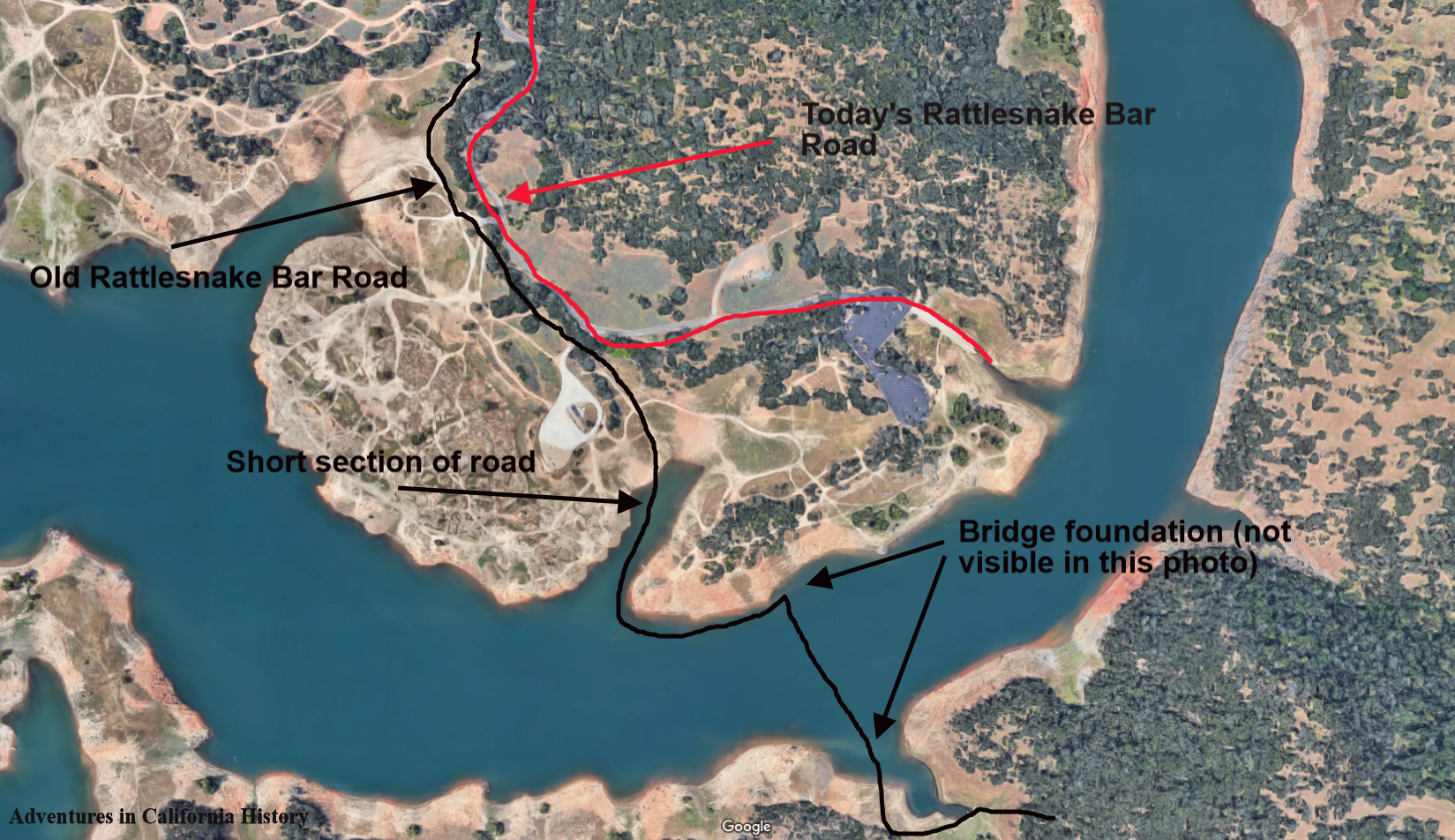
We have located the short sections of the road in the photo on the map below. You can also see the bridge foundation locations from this satellite photo, though the lake submerges both.
We enjoyed checking out the surreal landscape of a low Folsom Lake. All of the area around Folsom Lake was mined by gold seekers during the 19th and early 20th Centuries. That with the rising and lowering of the reservoir has created an otherworldly landscape with multiple levels of dirt of different colors. Quite striking and combined with the history of the area makes for a great day trip.
Below is a photograph of the old bridge. There is a man and a boy in the photograph along with smoke coming out of the bridge tenders shack. The printing above the man reads, “All persons driving or riding faster than a walk over this bridge will be fined to the extent of the law.”
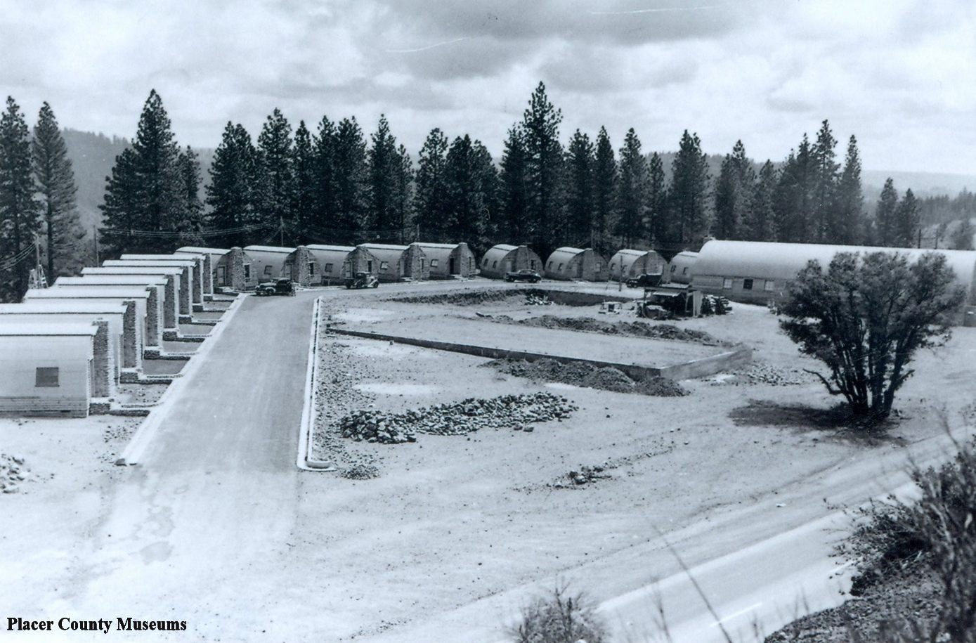
Quonset Hut Motel on Highway 40, just outside Colfax. Click the photo for closer view. Photo: Placer County Museums.
The Quonset Hut Motel near Colfax
The Quonset Hut Motel just outside of Colfax was built right after WWII when war surplus Quonset Huts were made available to the public. They became quite popular for all sorts of buildings as they could be gotten fairly cheap and were quite portable, as the photo below shows.
Quonset Hut being installed in Japan just after the end of WWII.
Quonset is a name for a small town in Rhode Island, where the military manufactured the huts for the WWII war effort. . Quonset is an Algonquian word meaning "small, long place."
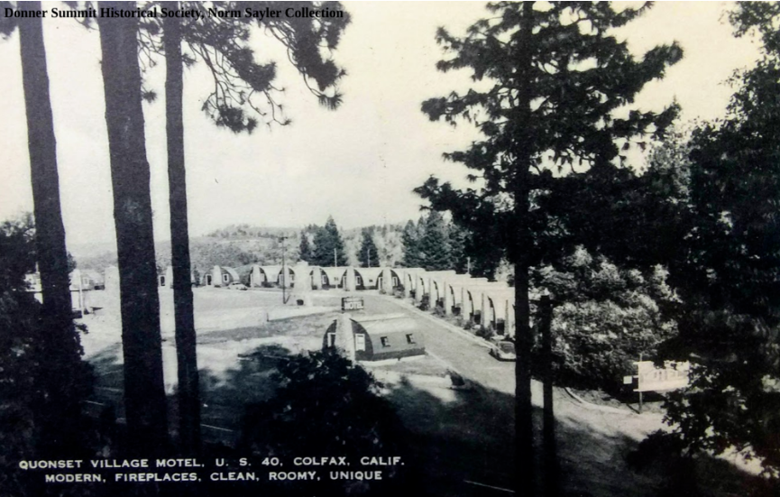
Over the years, Quonset Huts were used for many different types of business and even as homes. In this case, a motel was developed, taking advantage of the huts. The photo at the top of the post looks to be just before the later one taken below. The large Quonset in the first photo seems to be missing in the bottom photo, though the rock chimneys seem to be standing.
A different view of the Quonset Hut Motel. Photo: Donner Summit Historical Society, Norm Sayler Collection.
Today there is only one Quonset Hut left. The site can be visited by heading north from Colfax on Highway 174. Interestingly, the Lincoln Highway, 1913 to 1927, took a course where the owner eventually placed the Quonset Huts. You can see the route on the bottom map. During the motel's existence, the newer Highway 40 passed straight in front of the site.
Quonset Hut Motel site today on Highway 174, Colfax.
